

Long Island Sound - Laminated Nautical Navigation & Fishing Chart by Captain Segull's Nautical Sportfishing Charts | Chart # LI15
US$11.43
Price when purchased online
Free shipping
Free 30-day returns
Sold and shipped by hikari.fi
We aim to show you accurate product information. Manufacturers, suppliers and others provide what you see here.
Product details
| Management number | 217821983 | Release Date | 2026/05/03 | List Price | US$11.43 | Model Number | 217821983 | ||
|---|---|---|---|---|---|---|---|---|---|
| Category | |||||||||
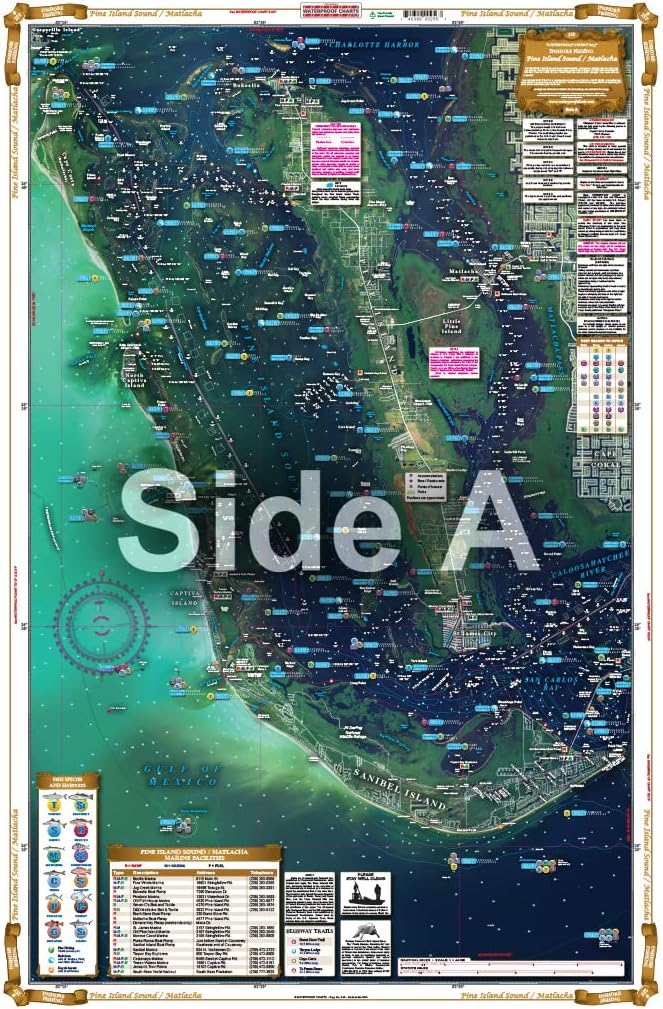
Inshore/Nearshore Fishing Chart: Side A is from Whitestone, NY east to the Housatonic River or Stony Brook, NY. has a detail of Captain Harbor, Norwalk Harbor and Smithtown Bay. Side B is from the Housatonic River east to Orient Point, NY or South Lyme, CT Double sided laminated fishing Chart. Shows fishing areas, wrecks, reefs, local names and amenities in GPS out to the thousandths of a minute. 19.5" x 26.5" Uses NOAA charts 12354 & 12363
- Laminated Fishing Chart
| Size | 19.5" x 26.5" |
|---|---|
| Color | waterproof laminated |
| Brand Name | Captain Segull's Sportfishing Chart |
| Item Weight | 16 ounces |
| Part Number | LI15 |
| Manufacturer | Captain Segull's Nautical Charts, Inc. |
| Package Weight | 0.6 Pounds |
| Item Package Dimensions L x W x H | 27 x 19.5 x 0.1 inches |
Bestseller ranking
Indoor Fountain Accessories


Customers who viewed this product also viewed
Charts & Maps


Correction of product information
If you notice any omissions or errors in the product information on this page, please use the correction request form below.
Correction Request Form